|
search place name
|
||
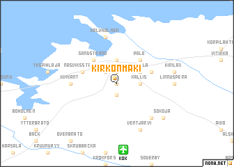
Kirkonmäki (Länsi-Suomen Lääni, Finland)Kirkonmäki is a town in the Länsi-Suomen Lääni region of Finland. An overview map of the region around Kirkonmäki is displayed below.
regional and 3d topo map of Kirkonmäki, Finland ::
Kirkonmäki airports ::
The nearest airport is KOK - Kruunupyy, located 10.7 km south of Kirkonmäki.
Other airports nearby include KAU - Kauhava (77.0 km south), VAA - Vaasa (109.4 km south west), LLA - Lulea Kallax (198.5 km north), KEM - Kemi Tornio (229.9 km north), Nearby towns ::
Kyrkbacken (0.0km north) //
Karleby (1.9km north) //
Kaarlela (1.9km north) //
Storby (1.9km south) //
Karleby (2.0km north west) //
Kokkola (2.0km north west) //
Halkokari (3.7km north) //
Kallis (1.6km east) //
Närvilä (2.5km north east) //
Sannanranta (4.1km north west) //
Sandstrand (4.1km north west) //
Palo (4.1km north east) //
Kaustar (3.1km north east) //
Leenalanperä (3.1km north west) //
Kaustari (3.1km north east) //
Näsviksstrand (3.1km north west) //
Kvikant (3.3km west) //
Kalvholmen (7.5km north) //
Rasmus (6.1km south east) //
Ventjärvi (7.6km south) //
Sokoja (6.5km south east) //
Såka (6.5km south east) //
[all distances 'as the bird flies' and approximate] 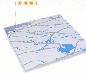 Places with similar names to Kirkonmäki, Finland ::
// Kirkonmäki (FI)
// Korkinmäki (FI)
Disclaimer :: Information on this page comes without warranty of any kind |
||
|
Where is Kirkonmäki? Elevation and coordinates ::
Latitude (lat): 63°49'0"N Longitude (lon): 23°8'0"E
(map arrows pan, magnifying glasses zoom) |
||
|
Visiting Kirkonmäki? Hotel/Accommodation ::
Book a hotel in Kirkonmäki Travel Guide ::
Buy a travel guide for Finland rental cars ::
car rental offers GPS waypoint ::
download a GPX waypoint (PoI) of Kirkonmäki for your GPS receiver
|
||