|
search place name
|
||
Labby (Etelä-Suomen Lääni, Finland)Labby is a town in the Etelä-Suomen Lääni region of Finland. An overview map of the region around Labby is displayed below.
regional and 3d topo map of Labby, Finland ::

Labby airports ::
The nearest airport is QVY - Utti, located 53.9 km north east of Labby.
Other airports nearby include HEM - Helsinki Malmi (74.2 km south west), HEL - Helsinki Vantaa (75.5 km west), LPP - Lappeenranta (116.9 km north east), MIK - Mikkeli (136.6 km north), Nearby towns ::
Harsböle (1.9km south) //
Hindersby (3.7km north) //
Bäckby (3.8km north) //
Tavastby (3.3km south west) //
Hommansby (3.6km west) //
Torpparinmäki (6.9km south) //
Torparbacken (6.9km south) //
Påvalsby (6.2km south west) //
Kapellby (6.2km north west) //
Gislom (8.3km south) //
Skogby (7.9km south) //
Kuggom (7.3km south west) //
[all distances 'as the bird flies' and approximate] 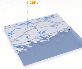 Places with similar names to Labby, Finland ::
Disclaimer :: Information on this page comes without warranty of any kind |
||
|
Where is Labby? Elevation and coordinates ::
Latitude (lat): 60°33'0"N Longitude (lon): 26°15'0"E
(map arrows pan, magnifying glasses zoom) |
||
|
Visiting Labby? Hotel/Accommodation ::
Book a hotel in Labby Travel Guide ::
Buy a travel guide for Finland rental cars ::
car rental offers GPS waypoint ::
download a GPX waypoint (PoI) of Labby for your GPS receiver
|
||