|
search place name
|
||
Östanåker (Ahvenanmaa, Finland)Östanåker is a town in the Ahvenanmaa region of Finland. An overview map of the region around Östanåker is displayed below.
regional and 3d topo map of Östanåker, Finland ::

Östanåker airports ::
The nearest airport is MHQ - Mariehamn, located 9.4 km south of Östanåker.
Other airports nearby include ARN - Stockholm Arlanda (127.0 km south west), BMA - Stockholm Bromma (145.4 km south west), POR - Pori (173.8 km north east), Nearby towns ::
Rönnhem (1.0km north) //
Norrgård (1.0km south east) //
Ringsböle (1.0km south east) //
Emkarby (1.1km north west) //
Karrböle (3.1km south east) //
Jans (2.8km south east) //
Kullaö (2.4km west) //
Vikhem (2.4km west) //
Norrsunda (4.5km south) //
Bjärström (2.5km west) //
Andersböle (3.5km south east) //
Åttböle (4.9km north) //
Grins (3.2km south east) //
Svartsmara (5.0km north) //
Stornäs (3.1km north east) //
Markusböle (5.3km north) //
Björkbacka (2.9km west) //
Buskböle (3.6km south east) //
Gölby (3.6km south east) //
Vargsunda (3.9km south west) //
Ulvsby (5.5km south) //
Bamböle (4.2km north west) //
Pellas (3.3km west) //
Rågetsböle (6.7km north) //
Markusas (5.0km south east) //
Ingby (5.1km south east) //
Möckelby (6.5km south) //
Södersunda (6.5km south) //
Pålsböle (6.9km north) //
[all distances 'as the bird flies' and approximate] 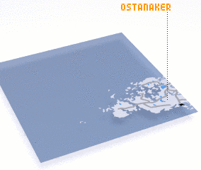
Disclaimer :: Information on this page comes without warranty of any kind |
||
|
Where is Östanåker? Elevation and coordinates ::
Latitude (lat): 60°12'22"N Longitude (lon): 19°54'9"E
(map arrows pan, magnifying glasses zoom) |
||
|
Visiting Östanåker? Hotel/Accommodation ::
Book a hotel in Östanåker Travel Guide ::
Buy a travel guide for Finland rental cars ::
car rental offers GPS waypoint ::
download a GPX waypoint (PoI) of Östanåker for your GPS receiver
|
||