|
search place name
|
||
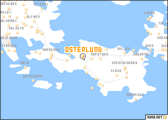
Österlund (Ahvenanmaa, Finland)Österlund is a town in the Ahvenanmaa region of Finland. An overview map of the region around Österlund is displayed below.
regional and 3d topo map of Österlund, Finland ::
Österlund airports ::
The nearest airport is MHQ - Mariehamn, located 13.1 km north west of Österlund.
Other airports nearby include POR - Pori (181.2 km north east), Nearby towns ::
Hellestorp (0.3km north) //
Karlberg (1.5km south) //
Bengtsböle (0.9km east) //
Högvalla (2.0km north) //
Lemland (2.2km north) //
Norrgård (2.3km north) //
Bistorp (2.4km north) //
Nyäng (2.8km south) //
Norrby (2.4km north west) //
Nygård (1.9km north west) //
Rörstorp (1.8km east) //
Söderby (1.9km west) //
Björkebo (4.3km south) //
Bastvik (3.4km north east) //
Västeränga (5.5km south) //
Näset (6.3km south) //
Mellangård (5.9km south) //
Norrgård (3.9km west) //
Nedre Börs (3.8km west) //
Knutsboda (3.8km west) //
Flaka (4.9km south east) //
[all distances 'as the bird flies' and approximate] 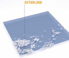 Places with similar names to Österlund, Finland ::
Disclaimer :: Information on this page comes without warranty of any kind |
||
|
Where is Österlund? Elevation and coordinates ::
Latitude (lat): 60°3'49"N Longitude (lon): 20°6'5"E
(map arrows pan, magnifying glasses zoom) |
||
|
Visiting Österlund? Hotel/Accommodation ::
Book a hotel in Österlund Travel Guide ::
Buy a travel guide for Finland rental cars ::
car rental offers GPS waypoint ::
download a GPX waypoint (PoI) of Österlund for your GPS receiver
|
||