|
search place name
|
||
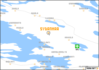
Sydänmaa (Itä-Suomen Lääni, Finland)Sydänmaa is a town in the Itä-Suomen Lääni region of Finland. An overview map of the region around Sydänmaa is displayed below.
regional and 3d topo map of Sydänmaa, Finland ::
Sydänmaa airports ::
The nearest airport is SVL - Savonlinna, located 6.7 km south east of Sydänmaa.
Other airports nearby include VRK - Varkaus (55.4 km north west), JOE - Joensuu (85.3 km north east), MIK - Mikkeli (92.9 km west), LPP - Lappeenranta (111.2 km south), Nearby towns ::
Niittylahti (3.8km south) //
Ylenmäki (5.6km north) //
Tolvanniemi (5.6km south) //
Karvila (5.6km north) //
Makkola (3.9km south east) //
Hannolanpelto (7.6km south) //
Eerikkälä (7.6km north) //
Muhola (7.9km north) //
[all distances 'as the bird flies' and approximate] 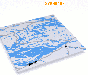 Places with similar names to Sydänmaa, Finland ::
// Stenum (DE)
// Süd Dunum (DE)
// Sténoma (GR)
// Steinmo (NO)
// Sayyid Nı‘mah (IQ)
// Stannum (AU)
// Stånum (DK)
// Stenum (DK)
// Saitaniemi (SE)
// Stannum (SE)
Disclaimer :: Information on this page comes without warranty of any kind |
||
|
Where is Sydänmaa? Elevation and coordinates ::
Latitude (lat): 61°59'0"N Longitude (lon): 28°51'0"E
(map arrows pan, magnifying glasses zoom) |
||
|
Visiting Sydänmaa? Hotel/Accommodation ::
Book a hotel in Sydänmaa Travel Guide ::
Buy a travel guide for Finland rental cars ::
car rental offers GPS waypoint ::
download a GPX waypoint (PoI) of Sydänmaa for your GPS receiver
|
||