|
search place name
|
||
Sydenperä (Länsi-Suomen Lääni, Finland)Sydenperä is a town in the Länsi-Suomen Lääni region of Finland. An overview map of the region around Sydenperä is displayed below.
regional and 3d topo map of Sydenperä, Finland ::

Sydenperä airports ::
The nearest airport is TKU - Turku, located 27.8 km south east of Sydenperä.
Other airports nearby include POR - Pori (89.9 km north), MHQ - Mariehamn (122.6 km south west), TMP - Tampere Pirkkala (127.3 km north east), Nearby towns ::
Lauttanpää (0.9km south east) //
Valaskallio (1.4km south east) //
Aarlahti (1.6km west) //
Korvensuu (3.2km north) //
Saari (2.7km south east) //
Kaukurla (2.2km east) //
Katavainen (2.6km south east) //
Huoli (2.5km north east) //
Meripää (4.7km south) //
Kirkkomäki (2.7km north west) //
Vähä (3.0km north east) //
Pyhä (2.7km east) //
Raveanmäki (3.0km north east) //
Halso (5.2km north) //
Tammisto (4.2km north east) //
Lehtinen (4.8km south east) //
Kaulakko (6.1km south) //
Karjakoski (6.2km north) //
Kaskinen (4.4km south east) //
Ranta-Vakkinen (5.8km south) //
Lahdenkulma (3.3km east) //
Hyntilä (6.9km north) //
Ihalainen (7.0km north) //
Soranen (7.7km south) //
Haijainen (4.2km south east) //
Kivikylä (7.2km north) //
Uhlu (6.2km south east) //
Ennys (4.2km west) //
Irjala (4.8km south west) //
[all distances 'as the bird flies' and approximate] 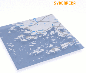 Places with similar names to Sydenperä, Finland ::
Disclaimer :: Information on this page comes without warranty of any kind |
||
|
Where is Sydenperä? Elevation and coordinates ::
Latitude (lat): 60°39'18"N Longitude (lon): 21°50'37"E
(map arrows pan, magnifying glasses zoom) |
||
|
Visiting Sydenperä? Hotel/Accommodation ::
Book a hotel in Sydenperä Travel Guide ::
Buy a travel guide for Finland rental cars ::
car rental offers GPS waypoint ::
download a GPX waypoint (PoI) of Sydenperä for your GPS receiver
|
||