|
search place name
|
||
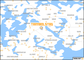
Tärnbolstad (Ahvenanmaa, Finland)Tärnbolstad is a town in the Ahvenanmaa region of Finland. An overview map of the region around Tärnbolstad is displayed below.
regional and 3d topo map of Tärnbolstad, Finland ::
Tärnbolstad airports ::
The nearest airport is MHQ - Mariehamn, located 16.5 km south of Tärnbolstad.
Other airports nearby include POR - Pori (166.3 km north east), Nearby towns ::
Mangelbo (0.9km east) //
Hjortö (2.4km north east) //
Pålsböle (1.8km west) //
Finström (1.8km west) //
Ödkarby (3.8km north) //
Germundö (2.6km north east) //
Godby (4.1km south east) //
Stornäs (4.9km south) //
Brantsböle (2.8km west) //
Markusböle (3.2km south west) //
Torrbolstad (3.3km north west) //
Ämnäs (5.6km south) //
Åttböle (3.3km south west) //
Norrberg (6.5km south) //
Haga (4.6km north east) //
Laby (6.0km north) //
Gibböle (6.3km south) //
Strömsgärdan (6.0km south) //
Rågetsböle (3.7km west) //
Haraldsby (4.1km south east) //
Tjudö (7.5km north) //
Näs (6.9km north east) //
Kvarnbo (4.7km north east) //
Norra Vandö (7.0km north west) //
Jans (8.7km south) //
Grins (9.0km south) //
Ringsböle (7.9km south) //
Västanträsk (8.7km north) //
Rönnhem (6.9km south west) //
[all distances 'as the bird flies' and approximate] 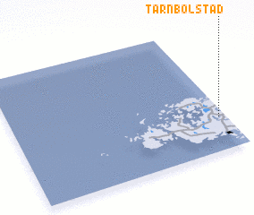 Places with similar names to Tärnbolstad, Finland :: Disclaimer :: Information on this page comes without warranty of any kind |
||
|
Where is Tärnbolstad? Elevation and coordinates ::
Latitude (lat): 60°16'0"N Longitude (lon): 19°58'0"E
(map arrows pan, magnifying glasses zoom) |
||
|
Visiting Tärnbolstad? Hotel/Accommodation ::
Book a hotel in Tärnbolstad Travel Guide ::
Buy a travel guide for Finland rental cars ::
car rental offers GPS waypoint ::
download a GPX waypoint (PoI) of Tärnbolstad for your GPS receiver
|
||