|
search place name
|
||
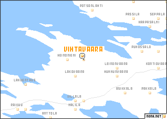
Vihtavaara (Itä-Suomen Lääni, Finland)Vihtavaara is a town in the Itä-Suomen Lääni region of Finland. An overview map of the region around Vihtavaara is displayed below.
regional and 3d topo map of Vihtavaara, Finland ::
Vihtavaara airports ::
The nearest airport is SVL - Savonlinna, located 39.6 km south west of Vihtavaara.
Other airports nearby include JOE - Joensuu (59.0 km north), VRK - Varkaus (89.5 km west), KUO - Kuopio (133.8 km north west), LPP - Lappeenranta (143.4 km south west), Nearby towns ::
Kankkula (0.0km north) //
Heinoniemi (1.7km west) //
Lakovaara (3.8km south) //
Leinonvaara (3.9km south east) //
Hummunvaara (5.1km south east) //
[all distances 'as the bird flies' and approximate] 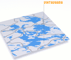 Places with similar names to Vihtavaara, Finland ::
// Vitavara (RU)
// Vaidavere (EE)
// Võduvere (EE)
// Võduvere (EE)
// Võidivere (EE)
// Videferre (ES)
// Vatovory (MG)
// Fateh Ghar (PK)
// Vihtavuori (FI)
// Hvidovre (DK)
Disclaimer :: Information on this page comes without warranty of any kind |
||
|
Where is Vihtavaara? Elevation and coordinates ::
Latitude (lat): 62°8'0"N Longitude (lon): 29°35'0"E
(map arrows pan, magnifying glasses zoom) |
||
|
Visiting Vihtavaara? Hotel/Accommodation ::
Book a hotel in Vihtavaara Travel Guide ::
Buy a travel guide for Finland rental cars ::
car rental offers GPS waypoint ::
download a GPX waypoint (PoI) of Vihtavaara for your GPS receiver
|
||