|
search place name
|
||
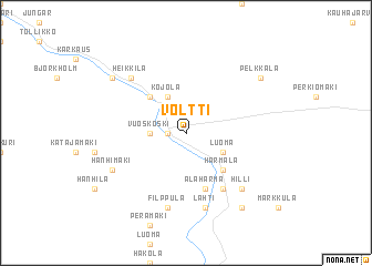
Voltti (Länsi-Suomen Lääni, Finland)Voltti is a town in the Länsi-Suomen Lääni region of Finland. An overview map of the region around Voltti is displayed below.
regional and 3d topo map of Voltti, Finland ::
Voltti airports ::
The nearest airport is KAU - Kauhava, located 20.6 km south east of Voltti.
Other airports nearby include KOK - Kruunupyy (51.2 km north), VAA - Vaasa (59.9 km south west), SFT - Skelleftea (172.5 km north west), KEV - Halli (188.1 km south east), Nearby towns ::
Knuutila (0.8km west) //
Myllymäki (1.9km north) //
Vuoskoski (1.7km west) //
Kojola (3.8km north) //
Luoma (2.5km south east) //
Holma (4.1km north west) //
Härmälä (4.1km south east) //
Alahärmä (5.6km south) //
Härmä (5.8km south) //
Filppula (7.5km south) //
Lahti (7.5km south) //
Heikkilä (6.1km north west) //
Hilli (6.1km south east) //
Hanhimäki (5.0km south west) //
Ekola (6.5km north west) //
Kankaanpää (7.8km south) //
Pelkkala (6.5km north east) //
[all distances 'as the bird flies' and approximate] 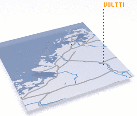 Places with similar names to Voltti, Finland ::
Disclaimer :: Information on this page comes without warranty of any kind |
||
|
Where is Voltti? Elevation and coordinates ::
Latitude (lat): 63°17'0"N Longitude (lon): 22°50'0"E
(map arrows pan, magnifying glasses zoom) |
||
|
Visiting Voltti? Hotel/Accommodation ::
Book a hotel in Voltti Travel Guide ::
Buy a travel guide for Finland rental cars ::
car rental offers GPS waypoint ::
download a GPX waypoint (PoI) of Voltti for your GPS receiver
|
||