|
search place name
|
||
Abermule (United Kingdom)Abermule is a town in United Kingdom. An overview map of the region around Abermule is displayed below.
regional and 3d topo map of Abermule, United Kingdom ::

Abermule airports ::
The nearest airport is CEG - Hawarden, located 73.8 km north of Abermule.
Other airports nearby include LPL - Liverpool (92.7 km north), BHX - Birmingham (101.3 km east), GLO - Golouchestershire Gloucestershire (101.8 km south east), MAN - Manchester (111.7 km north east), Nearby towns ::
Kerry (4.3km south west) //
Llandyssil (3.9km north east) //
Sarn (5.0km south east) //
Newtown (4.9km west) //
Berriew (7.7km north) //
Bettws Cedewain (5.8km north west) //
Montgomery (7.2km north east) //
[all distances 'as the bird flies' and approximate] 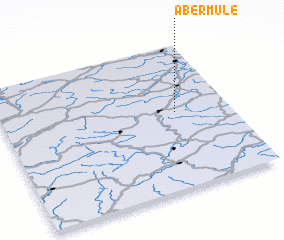 Places with similar names to Abermule, United Kingdom ::
// Abū Rumayl (SD)
// Abū Rumaylah (SD)
// Abū Rumaylah (SD)
// Abū Rumaylah (SD)
// Abū Rimāl (SY)
// Abū Rumaylah (OM)
// Abborremåla (SE)
// Abborremåla (SE)
// Ābu Ramla (ET)
Disclaimer :: Information on this page comes without warranty of any kind |
||
|
Where is Abermule? Elevation and coordinates ::
Latitude (lat): 52°32'0"N Longitude (lon): 3°14'0"W
Elevation (approx.): 146m (map arrows pan, magnifying glasses zoom) |
||
|
Visiting Abermule? Hotel/Accommodation ::
Book a hotel in Abermule Travel Guide ::
rental cars ::
car rental offers GPS waypoint ::
download a GPX waypoint (PoI) of Abermule for your GPS receiver
|
||