|
search place name
|
||
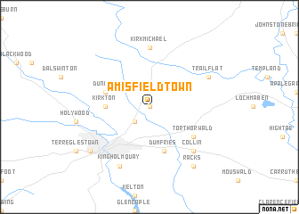
Amisfield Town (United Kingdom)Amisfield Town is a town in United Kingdom. An overview map of the region around Amisfield Town is displayed below.
regional and 3d topo map of Amisfield Town, United Kingdom ::
Amisfield Town airports ::
The nearest airport is CAX - Carlisle, located 52.4 km east of Amisfield Town.
Other airports nearby include PIK - Prestwick (78.1 km north west), EDI - Edinburgh (93.6 km north), GLA - Glasgow (100.3 km north west), BWF - Barrow Island Walney Island (111.4 km south), Nearby towns ::
Tinwald (0.0km north) //
Locharbriggs (2.1km south west) //
Kirkton (3.2km west) //
Duncow (3.7km north west) //
Dumfries (5.7km south) //
Torthorwald (4.9km south east) //
Kirkmichael (7.4km north) //
Collin (6.4km south east) //
Trailflat (5.6km north east) //
Kingholm Quay (7.7km south) //
Maxwelltown (7.0km south west) //
Racks (8.1km south east) //
[all distances 'as the bird flies' and approximate] 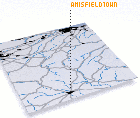 Places with similar names to Amisfield Town, United Kingdom :: Disclaimer :: Information on this page comes without warranty of any kind |
||
|
Where is Amisfield Town? Elevation and coordinates ::
Latitude (lat): 55°7'0"N Longitude (lon): 3°34'0"W
Elevation (approx.): 37m (map arrows pan, magnifying glasses zoom) |
||
|
Visiting Amisfield Town? Hotel/Accommodation ::
Book a hotel in Amisfield Town Travel Guide ::
rental cars ::
car rental offers GPS waypoint ::
download a GPX waypoint (PoI) of Amisfield Town for your GPS receiver
|
||