|
search place name
|
||
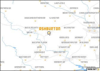
Ashburton (United Kingdom)Ashburton is a town in United Kingdom. An overview map of the region around Ashburton is displayed below.
regional and 3d topo map of Ashburton, United Kingdom ::
Ashburton airports ::
The nearest airport is PLH - Plymouth, located 27.3 km west of Ashburton.
Other airports nearby include EXT - Exeter (33.9 km north east), NQY - Newquai St Mawgan (88.8 km west), YEO - Yeovilton (95.7 km north east), CWL - Cardiff (102.0 km north), Nearby towns ::
Buckfastleigh (4.4km south west) //
Buckland in the Moor (4.0km north west) //
Ilsington (5.7km north) //
Woodland (4.0km south east) //
Dean (6.0km south west) //
Holne (4.7km west) //
Bickington (5.1km east) //
Widecombe in the Moor (6.6km north west) //
Staverton (6.6km south east) //
Dean Prior (7.8km south) //
Darlington (7.8km south) //
Broadhempston (6.0km south east) //
Bovey Tracey (8.8km north east) //
[all distances 'as the bird flies' and approximate] 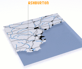 Places with similar names to Ashburton, United Kingdom ::
// Ashburton (US)
Disclaimer :: Information on this page comes without warranty of any kind |
||
|
Where is Ashburton? Elevation and coordinates ::
Latitude (lat): 50°31'0"N Longitude (lon): 3°45'0"W
Elevation (approx.): 81m (map arrows pan, magnifying glasses zoom) |
||
|
Visiting Ashburton? Hotel/Accommodation ::
Book a hotel in Ashburton Travel Guide ::
rental cars ::
car rental offers GPS waypoint ::
download a GPX waypoint (PoI) of Ashburton for your GPS receiver
|
||