|
search place name
|
||
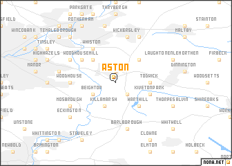
Aston (United Kingdom)Aston is a town in United Kingdom. An overview map of the region around Aston is displayed below.
regional and 3d topo map of Aston, United Kingdom ::
Aston airports ::
The nearest airport is WTN - Waddington, located 55.7 km east of Aston.
Other airports nearby include EMA - Nottingham East Midlands (57.8 km south), LBA - Leeds Bradford (62.2 km north), MAN - Manchester (64.9 km west), HUY - Humberside (67.8 km east), Nearby towns ::
Ulley (1.9km north) //
Wales (2.2km south east) //
Beighton (2.9km south west) //
Killamarsh (3.9km south) //
Swallownest (4.3km north west) //
Brampton en le Morthen (4.3km north east) //
Harthill (4.3km south east) //
Todwick (3.3km east) //
Kiveton Park (3.8km south east) //
Woodhouse Mill (5.0km north west) //
Treeton (5.0km north west) //
Whiston (6.0km north) //
Woodhouse (4.4km west) //
Barlborough (7.5km south) //
Wickersley (7.5km north) //
Orgreave (5.8km north west) //
Bramley (7.7km north) //
Mosbrough (5.8km south west) //
Eckington (7.1km south west) //
Canklow (8.6km north west) //
[all distances 'as the bird flies' and approximate] 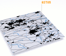 Places with similar names to Aston, United Kingdom ::
Disclaimer :: Information on this page comes without warranty of any kind |
||
|
Where is Aston? Elevation and coordinates ::
Latitude (lat): 53°21'0"N Longitude (lon): 1°18'0"W
Elevation (approx.): 71m (map arrows pan, magnifying glasses zoom) |
||
|
Visiting Aston? Hotel/Accommodation ::
Book a hotel in Aston Travel Guide ::
rental cars ::
car rental offers GPS waypoint ::
download a GPX waypoint (PoI) of Aston for your GPS receiver
|
||