|
search place name
|
||
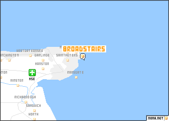
Broadstairs (United Kingdom)Broadstairs is a town in United Kingdom. An overview map of the region around Broadstairs is displayed below.
regional and 3d topo map of Broadstairs, United Kingdom ::
Broadstairs airports ::
The nearest airport is MSE - Manston, located 7.7 km west of Broadstairs.
Other airports nearby include SEN - Southend (57.2 km north west), CQF - Calais Dunkerque (57.2 km south east), LYX - Lydd (58.0 km south west), LTQ - Le Tourquet Le Touquet Paris Plage (95.2 km south), Nearby towns ::
Kingsgate (2.2km north west) //
Saint Peters (2.3km west) //
Cliftonville (3.0km north west) //
Margate (3.0km north west) //
Ramsgate (3.9km south) //
[all distances 'as the bird flies' and approximate] 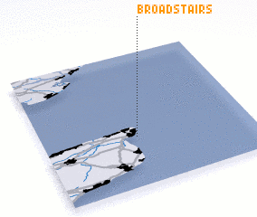 Places with similar names to Broadstairs, United Kingdom :: Disclaimer :: Information on this page comes without warranty of any kind |
||
|
Where is Broadstairs? Elevation and coordinates ::
Latitude (lat): 51°22'0"N Longitude (lon): 1°27'0"E
Elevation (approx.): -32768m (map arrows pan, magnifying glasses zoom) |
||
|
Visiting Broadstairs? Hotel/Accommodation ::
Book a hotel in Broadstairs Travel Guide ::
rental cars ::
car rental offers GPS waypoint ::
download a GPX waypoint (PoI) of Broadstairs for your GPS receiver
|
||