|
search place name
|
||
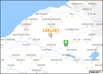
Chelvey (United Kingdom)Chelvey is a town in United Kingdom. An overview map of the region around Chelvey is displayed below.
regional and 3d topo map of Chelvey, United Kingdom ::
Chelvey airports ::
The nearest airport is BRS - Bristol, located 3.8 km south east of Chelvey.
Other airports nearby include FZO - Bristol Filton (18.1 km north east), CWL - Cardiff (40.1 km west), YEO - Yeovilton (44.4 km south), LYE - Lyneham (55.0 km east), Nearby towns ::
Brockley (0.0km north) //
Wrington (3.7km south) //
Nailsea (3.7km north) //
Congresbury (4.4km south west) //
Clapton in Gordano (5.6km north) //
Langford (5.7km south) //
Yatton (3.9km south west) //
Redhill (5.1km south east) //
Wraxall (6.0km north east) //
Portishead (7.4km north) //
Flax Bourton (5.0km east) //
Lulsgate Bottom (5.0km east) //
Weston Down (7.8km north) //
Churchill (7.8km south) //
Walton Down (7.2km north west) //
Butcombe (7.2km south east) //
Portbury (8.2km north east) //
Blagdon (8.2km south east) //
Sandford (8.7km south west) //
Pill (8.7km north east) //
[all distances 'as the bird flies' and approximate] 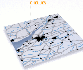 Places with similar names to Chelvey, United Kingdom ::
Disclaimer :: Information on this page comes without warranty of any kind |
||
|
Where is Chelvey? Elevation and coordinates ::
Latitude (lat): 51°24'0"N Longitude (lon): 2°46'0"W
Elevation (approx.): 25m (map arrows pan, magnifying glasses zoom) |
||
|
Visiting Chelvey? Hotel/Accommodation ::
Book a hotel in Chelvey Travel Guide ::
rental cars ::
car rental offers GPS waypoint ::
download a GPX waypoint (PoI) of Chelvey for your GPS receiver
|
||