|
search place name
|
||
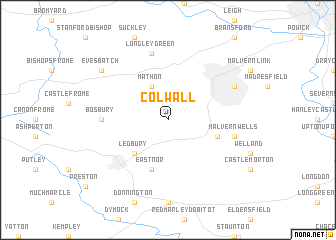
Colwall (United Kingdom)Colwall is a town in United Kingdom. An overview map of the region around Colwall is displayed below.
regional and 3d topo map of Colwall, United Kingdom ::
Colwall airports ::
The nearest airport is GLO - Golouchestershire Gloucestershire, located 25.8 km south east of Colwall.
Other airports nearby include BHX - Birmingham (59.8 km north east), FFD - Fairford (60.5 km south east), FZO - Bristol Filton (64.4 km south), BZZ - Brize Norton (66.4 km south east), Nearby towns ::
Mathon (3.9km north) //
Ledbury (4.4km south west) //
Little Malvern (3.9km south east) //
Eastnor (5.7km south) //
Bosbury (4.6km west) //
Malvern Wells (4.9km east) //
Longley Green (7.5km north) //
Great Malvern (5.9km north east) //
Evesbatch (7.2km north west) //
[all distances 'as the bird flies' and approximate] 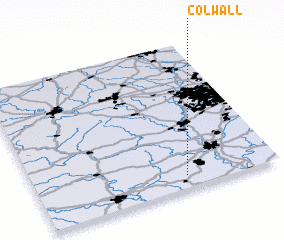 Places with similar names to Colwall, United Kingdom ::
Disclaimer :: Information on this page comes without warranty of any kind |
||
|
Where is Colwall? Elevation and coordinates ::
Latitude (lat): 52°5'0"N Longitude (lon): 2°23'0"W
Elevation (approx.): 100m (map arrows pan, magnifying glasses zoom) |
||
|
Visiting Colwall? Hotel/Accommodation ::
Book a hotel in Colwall Travel Guide ::
rental cars ::
car rental offers GPS waypoint ::
download a GPX waypoint (PoI) of Colwall for your GPS receiver
|
||