|
search place name
|
||
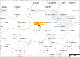
Cumnor (United Kingdom)Cumnor is a town in United Kingdom. An overview map of the region around Cumnor is displayed below.
regional and 3d topo map of Cumnor, United Kingdom ::
Cumnor airports ::
The nearest airport is OXF - Oxford Kidlington, located 13.4 km north of Cumnor.
Other airports nearby include BZZ - Brize Norton (17.7 km west), FFD - Fairford (31.8 km west), LYE - Lyneham (51.4 km south west), BBS - Blackbushe (55.2 km south east), Nearby towns ::
Appleton (2.2km south west) //
Wootton (3.0km south east) //
Northmoor (3.4km west) //
North Hinksey (3.9km north east) //
Wytham (6.0km north) //
Sunningwell (5.1km south east) //
Marcham (7.4km south) //
Cassington (7.5km north) //
Stanton Harcourt (5.0km west) //
Abingdon (6.5km south east) //
Eynsham (6.5km north west) //
Summertown (7.2km north east) //
Culham (8.2km south east) //
Garford (8.2km south west) //
[all distances 'as the bird flies' and approximate]  Places with similar names to Cumnor, United Kingdom ::
// Caimanera (CU)
// Caimanera (CU)
// Kawm an Nūr (EG)
// Kawm an Nūr (EG)
// Komunari (BG)
// Kommunar (UA)
// Ga-Monare (ZA)
// Kamennyy Yar (RU)
// Kommunar (RU)
// Kommunar (RU)
Disclaimer :: Information on this page comes without warranty of any kind |
||
|
Where is Cumnor? Elevation and coordinates ::
Latitude (lat): 51°43'0"N Longitude (lon): 1°20'0"W
Elevation (approx.): 105m (map arrows pan, magnifying glasses zoom) |
||
|
Visiting Cumnor? Hotel/Accommodation ::
Book a hotel in Cumnor Travel Guide ::
rental cars ::
car rental offers GPS waypoint ::
download a GPX waypoint (PoI) of Cumnor for your GPS receiver
|
||