|
search place name
|
||
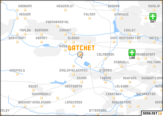
Datchet (United Kingdom)Datchet is a town in United Kingdom. An overview map of the region around Datchet is displayed below.
regional and 3d topo map of Datchet, United Kingdom ::
nearby GPS traces from timatio ::
Datchet airports ::
The nearest airport is LHR - London Heathrow, located 7.4 km east of Datchet.
Other airports nearby include NHT - Northolt (14.1 km north east), BBS - Blackbushe (25.2 km south west), FAB - Farnborough (25.8 km south west), ODH - Odiham (36.8 km south west), Nearby towns ::
Old Windsor (2.2km south west) //
Horton (2.2km south west) //
Wyrardisbury (2.2km south east) //
Windsor (3.0km north west) //
Slough (3.9km north) //
Langley Marish (3.9km north) //
Englefield Green (3.9km south) //
Eton (4.4km north west) //
Egham (5.6km south) //
Colnbrook (3.5km east) //
Stoke Poges (5.7km north) //
Canvey (6.0km north west) //
Staines (5.1km south east) //
Wentworth (7.5km south) //
Thorpe (6.6km south east) //
Iver (5.9km north east) //
Farnham Royal (8.2km north west) //
[all distances 'as the bird flies' and approximate] 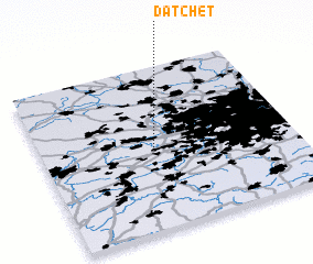 Places with similar names to Datchet, United Kingdom ::
// Tita Chuto (BO)
// Tadoucht (MA)
// Tateicht (MA)
// Dodesheide (DE)
// Dede-Ichetuy (RU)
// Dede-Ushoete (RU)
// Dodo-Ichetuy (RU)
// Deh Dasht (IR)
// Tīdasht (IR)
// Tū'ī Dasht (IR)
Disclaimer :: Information on this page comes without warranty of any kind |
||
|
Where is Datchet? Elevation and coordinates ::
Latitude (lat): 51°28'0"N Longitude (lon): 0°34'0"W
Elevation (approx.): 16m (map arrows pan, magnifying glasses zoom) |
||
|
Visiting Datchet? Hotel/Accommodation ::
Book a hotel in Datchet Travel Guide ::
rental cars ::
car rental offers GPS waypoint ::
download a GPX waypoint (PoI) of Datchet for your GPS receiver
|
||