|
search place name
|
||
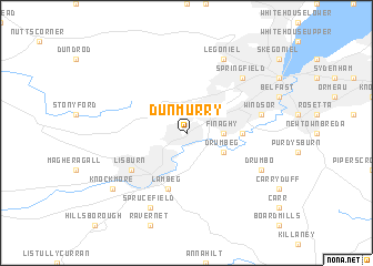
Dunmurry (United Kingdom)Dunmurry is a town in United Kingdom. An overview map of the region around Dunmurry is displayed below.
regional and 3d topo map of Dunmurry, United Kingdom ::
Dunmurry airports ::
The nearest airport is BHD - Belfast City, located 12.0 km north east of Dunmurry.
Other airports nearby include BFS - Belfast Aldergrove (17.6 km north west), LDY - Londonderry Eglinton (91.8 km north west), IOM - Isle Of Man (104.5 km south east), ENK - Enniskillen St Angelo (107.3 km west), Nearby towns ::
Finaghy (2.1km east) //
Drumbeg (2.8km south east) //
Balmoral (3.2km east) //
Lambeg (5.7km south) //
Lisburn (4.9km south west) //
Windsor (4.7km north east) //
Springfield (6.4km north east) //
Drumbo (5.7km south east) //
Sprucefield (7.7km south) //
Legoniel (7.7km north) //
Knockmore (7.0km south west) //
[all distances 'as the bird flies' and approximate] 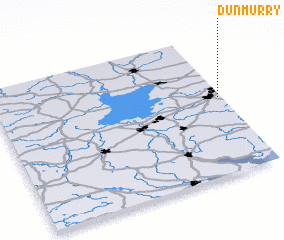 Places with similar names to Dunmurry, United Kingdom ::
// Tinoumirra (MA)
// Tinoummer (MA)
// Tanah Merah (MY)
// Dona Maria (PT)
// Dona Maria (PT)
// Dona Maria (PT)
// Doña María (CU)
// Donamaría (ES)
// Deh Nowmīr (IR)
// Dunmor (US)
Disclaimer :: Information on this page comes without warranty of any kind |
||
|
Where is Dunmurry? Elevation and coordinates ::
Latitude (lat): 54°33'0"N Longitude (lon): 6°1'0"W
Elevation (approx.): 32m (map arrows pan, magnifying glasses zoom) |
||
|
Visiting Dunmurry? Hotel/Accommodation ::
Book a hotel in Dunmurry Travel Guide ::
rental cars ::
car rental offers GPS waypoint ::
download a GPX waypoint (PoI) of Dunmurry for your GPS receiver
|
||