|
search place name
|
||
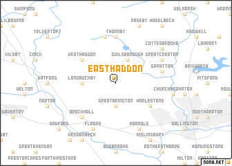
East Haddon (United Kingdom)East Haddon is a town in United Kingdom. An overview map of the region around East Haddon is displayed below.
regional and 3d topo map of East Haddon, United Kingdom ::
East Haddon airports ::
The nearest airport is CVT - Coventry, located 32.5 km west of East Haddon.
Other airports nearby include BHX - Birmingham (52.7 km west), OXF - Oxford Kidlington (55.6 km south), EMA - Nottingham East Midlands (62.8 km north), LTN - London Luton (64.9 km south east), Nearby towns ::
Great Brington (3.7km south) //
Guilsborough (3.9km north) //
Long Buckby (3.4km west) //
Harlestone (5.0km south east) //
West Haddon (5.0km north west) //
Thornby (7.4km north) //
Cold Ashby (7.5km north) //
Spratton (4.9km east) //
Brockhall (6.5km south west) //
Floore (7.8km south) //
Great Creaton (5.9km north east) //
Harpole (7.8km south) //
Cottesbrooke (7.2km north east) //
[all distances 'as the bird flies' and approximate] 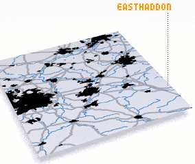 Places with similar names to East Haddon, United Kingdom ::
// East Howdon (GB)
Disclaimer :: Information on this page comes without warranty of any kind |
||
|
Where is East Haddon? Elevation and coordinates ::
Latitude (lat): 52°18'0"N Longitude (lon): 1°1'0"W
Elevation (approx.): 117m (map arrows pan, magnifying glasses zoom) |
||
|
Visiting East Haddon? Hotel/Accommodation ::
Book a hotel in East Haddon Travel Guide ::
rental cars ::
car rental offers GPS waypoint ::
download a GPX waypoint (PoI) of East Haddon for your GPS receiver
|
||