|
search place name
|
||
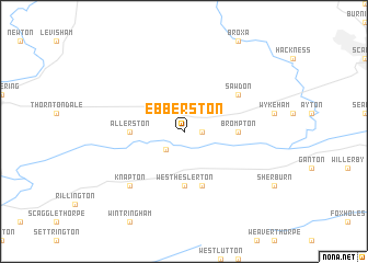
Ebberston (United Kingdom)Ebberston is a town in United Kingdom. An overview map of the region around Ebberston is displayed below.
regional and 3d topo map of Ebberston, United Kingdom ::
Ebberston airports ::
The nearest airport is MME - Teesside Durham Tees Valley Airport, located 63.0 km north west of Ebberston.
Other airports nearby include HUY - Humberside (73.3 km south), LBA - Leeds Bradford (79.7 km south west), NCL - Newcastle (115.4 km north west), WTN - Waddington (117.0 km south), Nearby towns ::
Snainton (1.1km east) //
Yedingham (2.1km south west) //
West Heslerton (5.6km south) //
Brompton (3.3km east) //
Allerston (3.3km west) //
East Heslerton (5.7km south) //
Sawdon (4.9km north east) //
Knapton (6.4km south west) //
[all distances 'as the bird flies' and approximate] 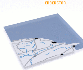
Disclaimer :: Information on this page comes without warranty of any kind |
||
|
Where is Ebberston? Elevation and coordinates ::
Latitude (lat): 54°13'0"N Longitude (lon): 0°36'0"W
Elevation (approx.): 21m (map arrows pan, magnifying glasses zoom) |
||
|
Visiting Ebberston? Hotel/Accommodation ::
Book a hotel in Ebberston Travel Guide ::
rental cars ::
car rental offers GPS waypoint ::
download a GPX waypoint (PoI) of Ebberston for your GPS receiver
|
||