|
search place name
|
||
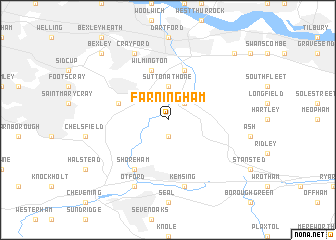
Farningham (United Kingdom)Farningham is a town in United Kingdom. An overview map of the region around Farningham is displayed below.
regional and 3d topo map of Farningham, United Kingdom ::
Farningham airports ::
The nearest airport is BQH - Biggin Hill, located 13.4 km west of Farningham.
Other airports nearby include LCY - London City (19.1 km north west), LGW - London Gatwick (37.4 km south west), SEN - Southend (40.3 km north east), NHT - Northolt (48.7 km north west), Nearby towns ::
Eynsford (1.9km south) //
Horton Kirby (2.2km north east) //
Sutton at Hone (3.7km north) //
Darenth (5.7km north) //
Swanley Junction (3.9km north west) //
Wilmington (5.7km north) //
Shoreham (6.0km south west) //
Kemsing (7.5km south) //
Crayford (7.8km north) //
Otford (7.8km south) //
Stonewood (8.7km north east) //
Bexley (8.7km north west) //
[all distances 'as the bird flies' and approximate] 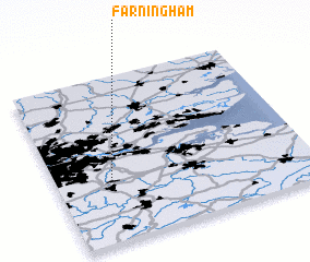 Places with similar names to Farningham, United Kingdom :: Disclaimer :: Information on this page comes without warranty of any kind |
||
|
Where is Farningham? Elevation and coordinates ::
Latitude (lat): 51°22'0"N Longitude (lon): 0°13'0"W
Elevation (approx.): 62m (map arrows pan, magnifying glasses zoom) |
||
|
Visiting Farningham? Hotel/Accommodation ::
Book a hotel in Farningham Travel Guide ::
rental cars ::
car rental offers GPS waypoint ::
download a GPX waypoint (PoI) of Farningham for your GPS receiver
|
||