|
search place name
|
||
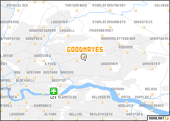
Goodmayes (United Kingdom)Goodmayes is a town in United Kingdom. An overview map of the region around Goodmayes is displayed below.
regional and 3d topo map of Goodmayes, United Kingdom ::
Goodmayes airports ::
The nearest airport is LCY - London City, located 8.0 km south west of Goodmayes.
Other airports nearby include BQH - Biggin Hill (26.9 km south), STN - London Stansted (36.3 km north), NHT - Northolt (37.1 km west), SEN - Southend (40.1 km east), Nearby towns ::
Seven Kings (1.2km west) //
Barkingside (3.0km north west) //
Barking (4.4km south west) //
Dagenham (3.9km south east) //
Friern Barnet (6.0km north) //
Chigwell (6.0km north) //
Ilford (5.0km west) //
Beckton (6.5km south west) //
Havering atte Bower (5.9km north east) //
East Ham (5.9km south west) //
Loughton (8.2km north west) //
Stapleford Abbots (8.2km north east) //
North Woolwich (8.2km south west) //
Rainham (8.7km south east) //
[all distances 'as the bird flies' and approximate] 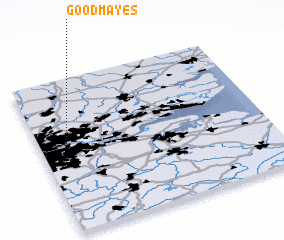 Places with similar names to Goodmayes, United Kingdom :: Disclaimer :: Information on this page comes without warranty of any kind |
||
|
Where is Goodmayes? Elevation and coordinates ::
Latitude (lat): 51°34'0"N Longitude (lon): 0°7'0"W
Elevation (approx.): 16m (map arrows pan, magnifying glasses zoom) |
||
|
Visiting Goodmayes? Hotel/Accommodation ::
Book a hotel in Goodmayes Travel Guide ::
rental cars ::
car rental offers GPS waypoint ::
download a GPX waypoint (PoI) of Goodmayes for your GPS receiver
|
||