|
search place name
|
||
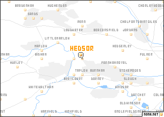
Hedsor (United Kingdom)Hedsor is a town in United Kingdom. An overview map of the region around Hedsor is displayed below.
regional and 3d topo map of Hedsor, United Kingdom ::
nearby GPS traces from timatio ::
Hedsor airports ::
The nearest airport is LHR - London Heathrow, located 17.4 km south east of Hedsor.
Other airports nearby include NHT - Northolt (18.4 km east), BBS - Blackbushe (27.6 km south west), FAB - Farnborough (31.2 km south), ODH - Odiham (39.5 km south west), Nearby towns ::
Cliveden (0.0km north) //
Cookham (1.2km west) //
Wooburn (1.9km north) //
Bourne End (2.2km north west) //
Taplow (3.7km south) //
Maidenhead (3.9km south) //
Burnham (4.4km south east) //
Bray (5.7km south) //
Bray Court (5.7km south) //
Loudwater (5.7km north) //
Dorney (6.0km south east) //
Little Marlow (5.1km north west) //
Penn (7.4km north) //
Farnham Royal (5.0km east) //
Beaconsfield (6.5km north east) //
[all distances 'as the bird flies' and approximate] 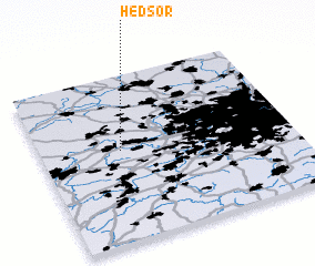 Places with similar names to Hedsor, United Kingdom ::
// Hódosér (HU)
// Hātsira (BD)
// Hātsira (BD)
// Hātsira (BD)
// Hātsira (BD)
// Hat'aesŏ-ri (KR)
// Hattusaari (FI)
// Hu-tzu-erh (TW)
// Haute Serre (FR)
Disclaimer :: Information on this page comes without warranty of any kind |
||
|
Where is Hedsor? Elevation and coordinates ::
Latitude (lat): 51°33'0"N Longitude (lon): 0°41'0"W
Elevation (approx.): 76m (map arrows pan, magnifying glasses zoom) |
||
|
Visiting Hedsor? Hotel/Accommodation ::
Book a hotel in Hedsor Travel Guide ::
rental cars ::
car rental offers GPS waypoint ::
download a GPX waypoint (PoI) of Hedsor for your GPS receiver
|
||