|
search place name
|
||
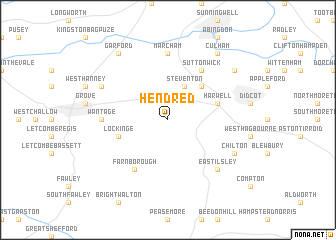
Hendred (United Kingdom)Hendred is a town in United Kingdom. An overview map of the region around Hendred is displayed below.
regional and 3d topo map of Hendred, United Kingdom ::
Hendred airports ::
The nearest airport is BZZ - Brize Norton, located 25.4 km north west of Hendred.
Other airports nearby include OXF - Oxford Kidlington (28.2 km north), FFD - Fairford (33.5 km west), BBS - Blackbushe (44.4 km south east), LYE - Lyneham (46.6 km west), Nearby towns ::
Steventon (3.9km north) //
Milton (4.4km north east) //
Lockinge (3.9km south west) //
Harwell (3.9km north east) //
Drayton (6.0km north) //
Sutton Wick (6.0km north) //
Farnborough (6.0km south west) //
Marcham (7.4km north) //
Wantage (4.6km west) //
East Ilsley (6.5km south east) //
Chilton (5.9km south east) //
East Hanney (5.9km north west) //
Sutton Courtenay (7.2km north east) //
Garford (8.2km north west) //
Culham (8.2km north east) //
[all distances 'as the bird flies' and approximate] 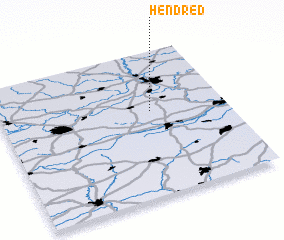 Places with similar names to Hendred, United Kingdom ::
// Hinterreit (DE)
// Hinterreute (DE)
// Hinterreute (DE)
// Hinterried (DE)
// Hinterrod (DE)
// Hundeort (DE)
// Hondurita (GT)
// Hondurita (VE)
// Ḩandarāt (SY)
// Ḩindarūt (OM)
Disclaimer :: Information on this page comes without warranty of any kind |
||
|
Where is Hendred? Elevation and coordinates ::
Latitude (lat): 51°35'0"N Longitude (lon): 1°20'0"W
Elevation (approx.): 128m (map arrows pan, magnifying glasses zoom) |
||
|
Visiting Hendred? Hotel/Accommodation ::
Book a hotel in Hendred Travel Guide ::
rental cars ::
car rental offers GPS waypoint ::
download a GPX waypoint (PoI) of Hendred for your GPS receiver
|
||