|
search place name
|
||
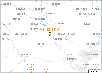
Highley (United Kingdom)Highley is a town in United Kingdom. An overview map of the region around Highley is displayed below.
regional and 3d topo map of Highley, United Kingdom ::
Highley airports ::
The nearest airport is BHX - Birmingham, located 43.2 km east of Highley.
Other airports nearby include CVT - Coventry (62.1 km east), GLO - Golouchestershire Gloucestershire (63.6 km south), EMA - Nottingham East Midlands (83.1 km north east), CEG - Hawarden (90.4 km north west), Nearby towns ::
Hampton (1.9km north) //
Alveley (2.3km east) //
Upper Arley (2.9km south east) //
Quatt (4.3km north east) //
Kinlet (4.3km south west) //
Fenngreen (3.4km east) //
Billingsley (3.9km north west) //
Glazeley (5.0km north west) //
Eardington (6.0km north) //
Romsley (4.5km east) //
Quatford (7.4km north) //
Bewdley (8.7km south east) //
[all distances 'as the bird flies' and approximate] 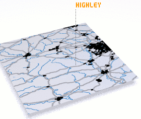 Places with similar names to Highley, United Kingdom ::
Disclaimer :: Information on this page comes without warranty of any kind |
||
|
Where is Highley? Elevation and coordinates ::
Latitude (lat): 52°27'0"N Longitude (lon): 2°23'0"W
Elevation (approx.): 115m (map arrows pan, magnifying glasses zoom) |
||
|
Visiting Highley? Hotel/Accommodation ::
Book a hotel in Highley Travel Guide ::
rental cars ::
car rental offers GPS waypoint ::
download a GPX waypoint (PoI) of Highley for your GPS receiver
|
||