|
search place name
|
||
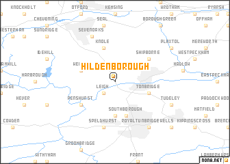
Hildenborough (United Kingdom)Hildenborough is a town in United Kingdom. An overview map of the region around Hildenborough is displayed below.
regional and 3d topo map of Hildenborough, United Kingdom ::
Hildenborough airports ::
The nearest airport is BQH - Biggin Hill, located 20.2 km north west of Hildenborough.
Other airports nearby include LGW - London Gatwick (30.2 km west), LCY - London City (36.2 km north), SEN - Southend (52.4 km north east), ESH - Shoreham By Sea Shoreham (55.0 km south west), Nearby towns ::
Leigh (2.2km south west) //
Bidborough (5.6km south) //
Knole (5.7km north) //
Weald (3.9km north west) //
Tonbridge (3.9km south east) //
Southborough (5.7km south) //
Shipborne (5.1km north east) //
Penshurst (5.1km south west) //
Speldhurst (7.5km south) //
Sevenoaks (7.8km north) //
Royal Tunbridge Wells (8.2km south east) //
[all distances 'as the bird flies' and approximate] 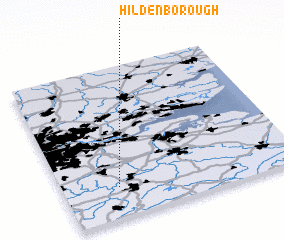 Places with similar names to Hildenborough, United Kingdom :: Disclaimer :: Information on this page comes without warranty of any kind |
||
|
Where is Hildenborough? Elevation and coordinates ::
Latitude (lat): 51°12'0"N Longitude (lon): 0°14'0"W
Elevation (approx.): 36m (map arrows pan, magnifying glasses zoom) |
||
|
Visiting Hildenborough? Hotel/Accommodation ::
Book a hotel in Hildenborough Travel Guide ::
rental cars ::
car rental offers GPS waypoint ::
download a GPX waypoint (PoI) of Hildenborough for your GPS receiver
|
||