|
search place name
|
||
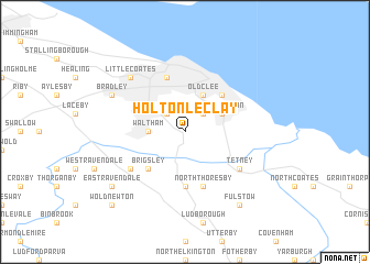
Holton le Clay (United Kingdom)Holton le Clay is a town in United Kingdom. An overview map of the region around Holton le Clay is displayed below.
regional and 3d topo map of Holton le Clay, United Kingdom ::
Holton le Clay airports ::
The nearest airport is HUY - Humberside, located 19.9 km west of Holton le Clay.
Other airports nearby include QCY - Coningsby (47.6 km south), WTN - Waddington (49.5 km south west), KNF - Marham (105.1 km south east), LBA - Leeds Bradford (112.2 km west), Nearby towns ::
Scartho (2.2km north west) //
Grimsby (2.2km north east) //
Waltham (2.2km west) //
Old Clee (3.9km north) //
Humberston (2.9km north east) //
Cleethorpes (4.3km north east) //
Brigsley (4.3km south west) //
Grainsby (5.6km south) //
Great Coates (5.7km north) //
North Thoresby (5.7km south) //
Tetney (5.0km south east) //
Ashby cum Fenby (5.0km south west) //
Little Coates (6.5km north west) //
Bradley (5.8km north west) //
East Ravendale (7.1km south west) //
Fulstow (8.1km south east) //
Wold Newton (8.6km south west) //
[all distances 'as the bird flies' and approximate] 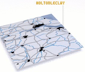 Places with similar names to Holton le Clay, United Kingdom :: Disclaimer :: Information on this page comes without warranty of any kind |
||
|
Where is Holton le Clay? Elevation and coordinates ::
Latitude (lat): 53°31'0"N Longitude (lon): 0°4'0"W
Elevation (approx.): 13m (map arrows pan, magnifying glasses zoom) |
||
|
Visiting Holton le Clay? Hotel/Accommodation ::
Book a hotel in Holton le Clay Travel Guide ::
rental cars ::
car rental offers GPS waypoint ::
download a GPX waypoint (PoI) of Holton le Clay for your GPS receiver
|
||