|
search place name
|
||
Iwerne Minster (United Kingdom)Iwerne Minster is a town in United Kingdom. An overview map of the region around Iwerne Minster is displayed below.
regional and 3d topo map of Iwerne Minster, United Kingdom ::

Iwerne Minster airports ::
The nearest airport is BOH - Bournemouth, located 29.4 km south east of Iwerne Minster.
Other airports nearby include YEO - Yeovilton (33.1 km west), SOU - Southampton (58.1 km east), BRS - Bristol (62.5 km north west), LYE - Lyneham (65.0 km north), Nearby towns ::
Fontmell Magna (1.9km north) //
Iwerne Courtney (2.2km south west) //
Compton Abbas (3.7km north) //
Melbury Abbas (5.7km north) //
Child Okeford (4.0km south west) //
Ashmore (4.0km north east) //
Stourpaine (5.7km south) //
East Orchard (5.1km north west) //
Blandford Forum (7.5km south) //
Tarrant Gunville (5.0km east) //
Durweston (7.5km south) //
Shaftesbury (7.5km north) //
West Orchard (5.0km west) //
Charlton (6.6km north east) //
Pimperne (6.6km south east) //
Shillingstone (6.0km south west) //
Ludwell (8.2km north east) //
[all distances 'as the bird flies' and approximate] 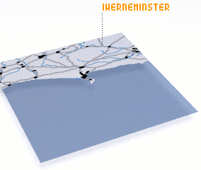 Places with similar names to Iwerne Minster, United Kingdom :: Disclaimer :: Information on this page comes without warranty of any kind |
||
|
Where is Iwerne Minster? Elevation and coordinates ::
Latitude (lat): 50°56'0"N Longitude (lon): 2°11'0"W
Elevation (approx.): 107m (map arrows pan, magnifying glasses zoom) |
||
|
Visiting Iwerne Minster? Hotel/Accommodation ::
Book a hotel in Iwerne Minster Travel Guide ::
rental cars ::
car rental offers GPS waypoint ::
download a GPX waypoint (PoI) of Iwerne Minster for your GPS receiver
|
||