|
search place name
|
||
Kirkistown (United Kingdom)Kirkistown is a town in United Kingdom. An overview map of the region around Kirkistown is displayed below.
regional and 3d topo map of Kirkistown, United Kingdom ::

Kirkistown airports ::
The nearest airport is BHD - Belfast City, located 32.5 km north west of Kirkistown.
Other airports nearby include BFS - Belfast Aldergrove (53.6 km north west), IOM - Isle Of Man (68.2 km south east), DUB - Dublin (123.9 km south west), LDY - Londonderry Eglinton (127.6 km north west), Nearby towns ::
Cloghy (2.1km south east) //
Ringboy (2.2km east) //
Portavogie (2.8km north east) //
Ardkeen (2.8km south west) //
Glastry (5.6km north) //
Kearney (5.7km south) //
Newcastle (5.7km south) //
Strangford (7.5km south) //
Kircubbin (6.4km north west) //
Nuns Quarter (8.1km north west) //
Portaferry (7.0km south west) //
[all distances 'as the bird flies' and approximate] 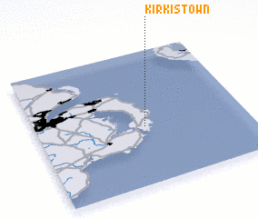 Places with similar names to Kirkistown, United Kingdom ::
// Grigston (US)
// Kregždėnai (LT)
// Kregždyne (LT)
// Krekštėnai (LT)
// Krikštėnai (LT)
// Croxton (US)
// Griggstown (US)
// Karagastenna (LK)
// Karagastenna (LK)
// Gurgu Sudan (NG)
Disclaimer :: Information on this page comes without warranty of any kind |
||
|
Where is Kirkistown? Elevation and coordinates ::
Latitude (lat): 54°26'0"N Longitude (lon): 5°29'0"W
Elevation (approx.): 5m (map arrows pan, magnifying glasses zoom) |
||
|
Visiting Kirkistown? Hotel/Accommodation ::
Book a hotel in Kirkistown Travel Guide ::
rental cars ::
car rental offers GPS waypoint ::
download a GPX waypoint (PoI) of Kirkistown for your GPS receiver
|
||