|
search place name
|
||
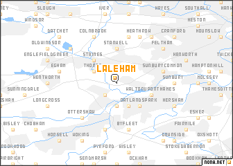
Laleham (United Kingdom)Laleham is a town in United Kingdom. An overview map of the region around Laleham is displayed below.
regional and 3d topo map of Laleham, United Kingdom ::
nearby GPS traces from timatio ::
Laleham airports ::
The nearest airport is LHR - London Heathrow, located 8.8 km north of Laleham.
Other airports nearby include NHT - Northolt (17.6 km north), FAB - Farnborough (24.7 km south west), BBS - Blackbushe (26.7 km west), LGW - London Gatwick (34.7 km south east), Nearby towns ::
Ashford (2.2km north east) //
Chertsey (2.2km south west) //
Addlestone (3.7km south) //
Weybridge (3.9km south) //
Thorpe (3.0km north west) //
Oatlands Park (4.4km south east) //
Staines (4.4km north west) //
Stanwell (5.6km north) //
Shepperton (3.9km south east) //
Walton upon Thames (3.9km south east) //
Sunbury Common (5.0km east) //
West Bedfont (7.5km north) //
Byfleet (7.5km south) //
West Byfleet (7.5km south) //
Ottershaw (6.6km south west) //
Heathrow (7.8km north) //
Colnbrook (7.8km north) //
Feltham (7.2km north east) //
New Bedfont (8.2km north east) //
Wyrardisbury (7.2km north west) //
[all distances 'as the bird flies' and approximate] 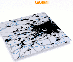
Disclaimer :: Information on this page comes without warranty of any kind |
||
|
Where is Laleham? Elevation and coordinates ::
Latitude (lat): 51°24'0"N Longitude (lon): 0°29'0"W
Elevation (approx.): 13m (map arrows pan, magnifying glasses zoom) |
||
|
Visiting Laleham? Hotel/Accommodation ::
Book a hotel in Laleham Travel Guide ::
rental cars ::
car rental offers GPS waypoint ::
download a GPX waypoint (PoI) of Laleham for your GPS receiver
|
||