|
search place name
|
||
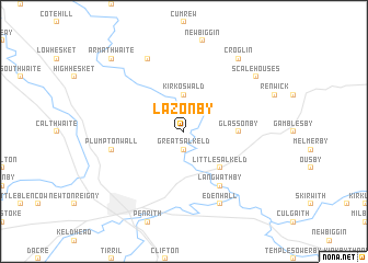
Lazonby (United Kingdom)Lazonby is a town in United Kingdom. An overview map of the region around Lazonby is displayed below.
regional and 3d topo map of Lazonby, United Kingdom ::
Lazonby airports ::
The nearest airport is CAX - Carlisle, located 23.8 km north of Lazonby.
Other airports nearby include NCL - Newcastle (73.0 km north east), BWF - Barrow Island Walney Island (76.4 km south west), MME - Teesside Durham Tees Valley Airport (85.8 km east), BLK - Blackpool (109.2 km south), Nearby towns ::
Great Salkeld (1.9km south) //
Kirkoswald (3.7km north) //
Little Salkeld (4.3km south east) //
Glassonby (3.2km east) //
Langwathby (6.0km south) //
Plumpton Wall (4.7km south west) //
Edenhall (7.7km south) //
Ainstable (7.7km north) //
Croglin (8.1km north east) //
Scalehouses (7.0km north east) //
Armathwaite (8.6km north west) //
[all distances 'as the bird flies' and approximate] 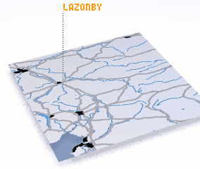 Places with similar names to Lazonby, United Kingdom ::
Disclaimer :: Information on this page comes without warranty of any kind |
||
|
Where is Lazonby? Elevation and coordinates ::
Latitude (lat): 54°44'0"N Longitude (lon): 2°42'0"W
Elevation (approx.): 119m (map arrows pan, magnifying glasses zoom) |
||
|
Visiting Lazonby? Hotel/Accommodation ::
Book a hotel in Lazonby Travel Guide ::
rental cars ::
car rental offers GPS waypoint ::
download a GPX waypoint (PoI) of Lazonby for your GPS receiver
|
||