|
search place name
|
||
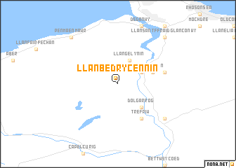
Llanbedr-y-cennin (United Kingdom)Llanbedr-y-cennin is a town in United Kingdom. An overview map of the region around Llanbedr-y-cennin is displayed below.
regional and 3d topo map of Llanbedr-y-cennin, United Kingdom ::
Llanbedr-y-cennin airports ::
The nearest airport is CEG - Hawarden, located 59.5 km east of Llanbedr-y-cennin.
Other airports nearby include LPL - Liverpool (69.5 km east), BLK - Blackpool (84.5 km north east), MAN - Manchester (107.5 km east), IOM - Isle Of Man (110.3 km north west), Nearby towns ::
Llangelynin (3.9km north) //
Caerhûn (2.9km north east) //
Dolgarrog (4.3km south east) //
Tal-y-Cafn (3.8km north east) //
Trefriw (6.0km south) //
Eglwys-Fâch (4.8km north east) //
Llanrwst (7.1km south east) //
Llanddoget (7.1km south east) //
Penmaen-mawr (8.6km north west) //
Llansantffraid Glan Conwy (8.6km north east) //
[all distances 'as the bird flies' and approximate]  Places with similar names to Llanbedr-y-cennin, United Kingdom :: Disclaimer :: Information on this page comes without warranty of any kind |
||
|
Where is Llanbedr-y-cennin? Elevation and coordinates ::
Latitude (lat): 53°12'0"N Longitude (lon): 3°52'0"W
Elevation (approx.): 262m (map arrows pan, magnifying glasses zoom) |
||
|
Visiting Llanbedr-y-cennin? Hotel/Accommodation ::
Book a hotel in Llanbedr-y-cennin Travel Guide ::
rental cars ::
car rental offers GPS waypoint ::
download a GPX waypoint (PoI) of Llanbedr-y-cennin for your GPS receiver
|
||