|
search place name
|
||
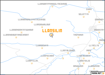
Llansilin (United Kingdom)Llansilin is a town in United Kingdom. An overview map of the region around Llansilin is displayed below.
regional and 3d topo map of Llansilin, United Kingdom ::
Llansilin airports ::
The nearest airport is CEG - Hawarden, located 40.8 km north of Llansilin.
Other airports nearby include LPL - Liverpool (60.0 km north), MAN - Manchester (84.0 km north east), BLK - Blackpool (104.9 km north), BHX - Birmingham (105.9 km south east), Nearby towns ::
Llangedwyn (4.3km south west) //
Llangadwaladr (4.3km north west) //
Llanfechain (7.5km south) //
Llanyblodwel (6.5km south east) //
Llansantffraid-ym-Mechain (7.7km south) //
Llanarmon Dyffryn-Ceiriog (7.1km north west) //
[all distances 'as the bird flies' and approximate]  Places with similar names to Llansilin, United Kingdom ::
// Lonasilian (VU)
// Lancelin (AU)
Disclaimer :: Information on this page comes without warranty of any kind |
||
|
Where is Llansilin? Elevation and coordinates ::
Latitude (lat): 52°50'0"N Longitude (lon): 3°11'0"W
Elevation (approx.): 144m (map arrows pan, magnifying glasses zoom) |
||
|
Visiting Llansilin? Hotel/Accommodation ::
Book a hotel in Llansilin Travel Guide ::
rental cars ::
car rental offers GPS waypoint ::
download a GPX waypoint (PoI) of Llansilin for your GPS receiver
|
||