|
search place name
|
||
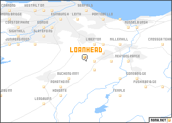
Loanhead (United Kingdom)Loanhead is a town in United Kingdom. An overview map of the region around Loanhead is displayed below.
regional and 3d topo map of Loanhead, United Kingdom ::
nearby GPS traces from timatio ::
Loanhead airports ::
The nearest airport is EDI - Edinburgh, located 16.7 km north west of Loanhead.
Other airports nearby include ADX - Leuchars (59.0 km north), DND - Dundee (65.7 km north), GLA - Glasgow (80.3 km west), PIK - Prestwick (98.7 km south west), Nearby towns ::
Polton (1.0km east) //
Hawthornden (2.1km south east) //
Lasswade (2.8km north east) //
Liberton (3.8km north) //
Craigmillar (4.2km north east) //
Gilmerton (4.2km north east) //
Auchendinny (4.3km south west) //
Bonnyrigg (3.1km east) //
Pomathorn (6.4km south west) //
Millerhill (5.6km north east) //
Carrington (5.6km south east) //
Howgate (8.0km south west) //
Dalry (8.5km north west) //
Temple (8.5km south east) //
[all distances 'as the bird flies' and approximate] 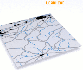 Places with similar names to Loanhead, United Kingdom ::
// Llano Hato (PA)
// Lan Nhút (VN)
// Liên Hội (3) (VN)
// Lønne Hede (DK)
// Lianhuadou (CN)
// Linhuaitou (CN)
// Linha Oito (BR)
// Le Nouhaud (FR)
// Le Nouhaut (FR)
// Loenhout (BE)
Disclaimer :: Information on this page comes without warranty of any kind |
||
|
Where is Loanhead? Elevation and coordinates ::
Latitude (lat): 55°52'0"N Longitude (lon): 3°9'0"W
Elevation (approx.): 132m (map arrows pan, magnifying glasses zoom) |
||
|
Visiting Loanhead? Hotel/Accommodation ::
Book a hotel in Loanhead Travel Guide ::
rental cars ::
car rental offers GPS waypoint ::
download a GPX waypoint (PoI) of Loanhead for your GPS receiver
|
||