|
search place name
|
||
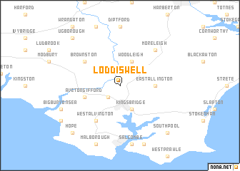
Loddiswell (United Kingdom)Loddiswell is a town in United Kingdom. An overview map of the region around Loddiswell is displayed below.
regional and 3d topo map of Loddiswell, United Kingdom ::
Loddiswell airports ::
The nearest airport is PLH - Plymouth, located 25.8 km north west of Loddiswell.
Other airports nearby include EXT - Exeter (53.3 km north east), NQY - Newquai St Mawgan (87.3 km west), YEO - Yeovilton (111.7 km north east), CWL - Cardiff (124.1 km north), Nearby towns ::
Churchstow (2.2km south west) //
Woodleigh (3.9km north) //
Kingsbridge (3.9km south) //
East Allington (3.6km east) //
Aveton Gifford (4.0km south west) //
Brownston (5.1km north west) //
West Alvington (6.0km south west) //
South Milton (6.0km south west) //
Moreleigh (6.6km north east) //
Halwell (6.6km north east) //
Ugborough (8.8km north west) //
South Pool (8.8km south east) //
Hope (8.8km south west) //
[all distances 'as the bird flies' and approximate] 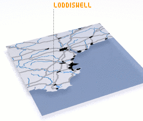
Disclaimer :: Information on this page comes without warranty of any kind |
||
|
Where is Loddiswell? Elevation and coordinates ::
Latitude (lat): 50°19'0"N Longitude (lon): 3°47'0"W
Elevation (approx.): 64m (map arrows pan, magnifying glasses zoom) |
||
|
Visiting Loddiswell? Hotel/Accommodation ::
Book a hotel in Loddiswell Travel Guide ::
rental cars ::
car rental offers GPS waypoint ::
download a GPX waypoint (PoI) of Loddiswell for your GPS receiver
|
||