|
search place name
|
||
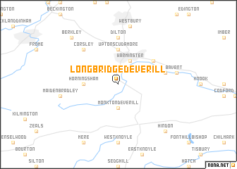
Longbridge Deverill (United Kingdom)Longbridge Deverill is a town in United Kingdom. An overview map of the region around Longbridge Deverill is displayed below.
regional and 3d topo map of Longbridge Deverill, United Kingdom ::
Longbridge Deverill airports ::
The nearest airport is YEO - Yeovilton, located 35.4 km south west of Longbridge Deverill.
Other airports nearby include LYE - Lyneham (40.3 km north), BRS - Bristol (43.5 km north west), FZO - Bristol Filton (47.8 km north west), BOH - Bournemouth (49.8 km south east), Nearby towns ::
Monkton Deverill (3.7km south) //
Warminster (3.9km north) //
Upton Scudamore (5.6km north) //
Horningsham (3.5km west) //
Bishopstrow (5.1km north east) //
Boreham (5.1km north east) //
Dilton (7.4km north) //
Norton Bavant (5.0km east) //
Corsley (6.6km north west) //
Berkley (8.7km north west) //
Hindon (8.8km south east) //
Chicklade (8.8km south east) //
[all distances 'as the bird flies' and approximate] 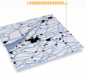 Places with similar names to Longbridge Deverill, United Kingdom :: Disclaimer :: Information on this page comes without warranty of any kind |
||
|
Where is Longbridge Deverill? Elevation and coordinates ::
Latitude (lat): 51°10'0"N Longitude (lon): 2°12'0"W
Elevation (approx.): 131m (map arrows pan, magnifying glasses zoom) |
||
|
Visiting Longbridge Deverill? Hotel/Accommodation ::
Book a hotel in Longbridge Deverill Travel Guide ::
rental cars ::
car rental offers GPS waypoint ::
download a GPX waypoint (PoI) of Longbridge Deverill for your GPS receiver
|
||