|
search place name
|
||
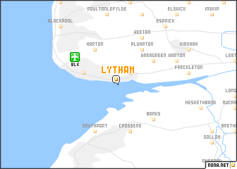
Lytham (United Kingdom)Lytham is a town in United Kingdom. An overview map of the region around Lytham is displayed below.
regional and 3d topo map of Lytham, United Kingdom ::
Lytham airports ::
The nearest airport is BLK - Blackpool, located 5.9 km north west of Lytham.
Other airports nearby include LPL - Liverpool (45.2 km south), BWF - Barrow Island Walney Island (48.4 km north west), CEG - Hawarden (61.8 km south), MAN - Manchester (62.3 km south east), Nearby towns ::
Brown Moss Side (2.2km north east) //
Saint Annes on the Sea (3.8km north west) //
Marton (6.0km north) //
Wrea Green (5.0km north east) //
Plumpton (6.0km north) //
Crossens (7.5km south) //
Banks (6.5km south east) //
Southport (7.7km south) //
Weeton (7.7km north) //
[all distances 'as the bird flies' and approximate] 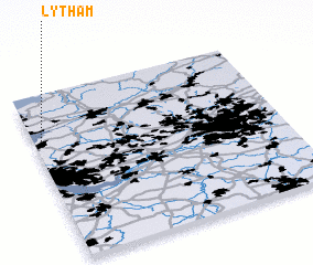 Places with similar names to Lytham, United Kingdom ::
Disclaimer :: Information on this page comes without warranty of any kind |
||
|
Where is Lytham? Elevation and coordinates ::
Latitude (lat): 53°44'0"N Longitude (lon): 2°58'0"W
Elevation (approx.): -32768m (map arrows pan, magnifying glasses zoom) |
||
|
Visiting Lytham? Hotel/Accommodation ::
Book a hotel in Lytham Travel Guide ::
rental cars ::
car rental offers GPS waypoint ::
download a GPX waypoint (PoI) of Lytham for your GPS receiver
|
||