|
search place name
|
||
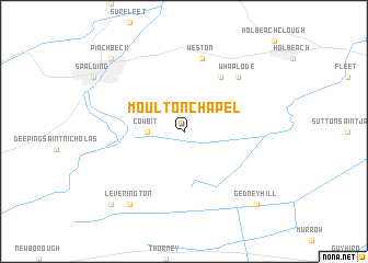
Moulton Chapel (United Kingdom)Moulton Chapel is a town in United Kingdom. An overview map of the region around Moulton Chapel is displayed below.
regional and 3d topo map of Moulton Chapel, United Kingdom ::
Moulton Chapel airports ::
The nearest airport is QCY - Coningsby, located 40.4 km north of Moulton Chapel.
Other airports nearby include KNF - Marham (43.9 km east), WTN - Waddington (56.5 km north west), MHZ - Mildenhall (56.6 km south east), CBG - Cambridge (61.4 km south), Nearby towns ::
Cowbit (2.2km west) //
Moulton (6.0km north) //
Weston (7.5km north) //
Whaplode (6.5km north east) //
Leverington (8.1km south west) //
Gedney Hill (8.7km south east) //
Crowland (8.7km south west) //
Pinchbeck (8.7km north west) //
[all distances 'as the bird flies' and approximate] 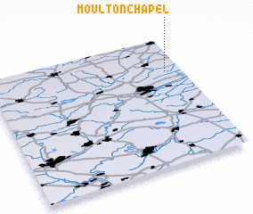 Places with similar names to Moulton Chapel, United Kingdom :: Disclaimer :: Information on this page comes without warranty of any kind |
||
|
Where is Moulton Chapel? Elevation and coordinates ::
Latitude (lat): 52°44'0"N Longitude (lon): 0°5'0"W
Elevation (approx.): 2m (map arrows pan, magnifying glasses zoom) |
||
|
Visiting Moulton Chapel? Hotel/Accommodation ::
Book a hotel in Moulton Chapel Travel Guide ::
rental cars ::
car rental offers GPS waypoint ::
download a GPX waypoint (PoI) of Moulton Chapel for your GPS receiver
|
||