|
search place name
|
||
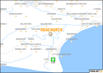
Newchurch (United Kingdom)Newchurch is a town in United Kingdom. An overview map of the region around Newchurch is displayed below.
regional and 3d topo map of Newchurch, United Kingdom ::
Newchurch airports ::
The nearest airport is LYX - Lydd, located 8.6 km south of Newchurch.
Other airports nearby include MSE - Manston (44.9 km north east), SEN - Southend (62.1 km north), BQH - Biggin Hill (71.2 km north west), CQF - Calais Dunkerque (72.1 km east), Nearby towns ::
Bilsington (3.9km north) //
New Romney (5.6km south) //
Aldington (5.7km north) //
Ruckinge (4.0km north west) //
Ivychurch (5.1km south west) //
Mersham (7.4km north) //
Burmarsh (4.7km east) //
Snave (5.0km west) //
Dymchurch (5.0km east) //
Old Romney (6.6km south west) //
Littlestone-on-Sea (7.8km south) //
Sellindge (8.8km north east) //
[all distances 'as the bird flies' and approximate] 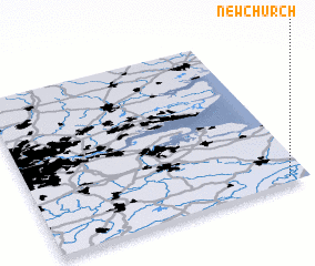 Places with similar names to Newchurch, United Kingdom ::
Disclaimer :: Information on this page comes without warranty of any kind |
||
|
Where is Newchurch? Elevation and coordinates ::
Latitude (lat): 51°2'0"N Longitude (lon): 0°56'0"W
Elevation (approx.): 1m (map arrows pan, magnifying glasses zoom) |
||
|
Visiting Newchurch? Hotel/Accommodation ::
Book a hotel in Newchurch Travel Guide ::
rental cars ::
car rental offers GPS waypoint ::
download a GPX waypoint (PoI) of Newchurch for your GPS receiver
|
||