|
search place name
|
||
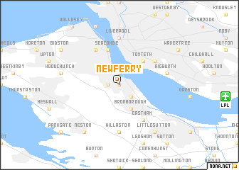
New Ferry (United Kingdom)New Ferry is a town in United Kingdom. An overview map of the region around New Ferry is displayed below.
regional and 3d topo map of New Ferry, United Kingdom ::
New Ferry airports ::
The nearest airport is LPL - Liverpool, located 10.2 km east of New Ferry.
Other airports nearby include CEG - Hawarden (19.2 km south), BLK - Blackpool (47.0 km north), MAN - Manchester (48.3 km east), BWF - Barrow Island Walney Island (88.7 km north), Nearby towns ::
Lower Bebington (0.0km north) //
Higher Bebington (1.1km west) //
Bebington (1.1km west) //
Rock Ferry (1.9km north) //
Port Sunlight (2.2km south east) //
Bromborough (3.9km south) //
Toxteth (4.3km north east) //
Seacombe (5.7km north) //
Dingle (5.0km north east) //
Birkenhead (6.0km north) //
Eastham (6.0km south) //
Willaston (7.4km south) //
Liverpool (7.4km north) //
Aigburth (4.8km north east) //
Neston (8.1km south west) //
Little Sutton (8.1km south east) //
[all distances 'as the bird flies' and approximate] 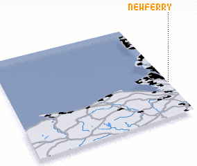 Places with similar names to New Ferry, United Kingdom ::
Disclaimer :: Information on this page comes without warranty of any kind |
||
|
Where is New Ferry? Elevation and coordinates ::
Latitude (lat): 53°21'0"N Longitude (lon): 3°0'0"W
Elevation (approx.): 22m (map arrows pan, magnifying glasses zoom) |
||
|
Visiting New Ferry? Hotel/Accommodation ::
Book a hotel in New Ferry Travel Guide ::
rental cars ::
car rental offers GPS waypoint ::
download a GPX waypoint (PoI) of New Ferry for your GPS receiver
|
||