|
search place name
|
||
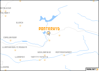
Pont-erwyd (United Kingdom)Pont-erwyd is a town in United Kingdom. An overview map of the region around Pont-erwyd is displayed below.
regional and 3d topo map of Pont-erwyd, United Kingdom ::
Pont-erwyd airports ::
The nearest airport is SWS - Swansea, located 91.7 km south of Pont-erwyd.
Other airports nearby include CEG - Hawarden (102.5 km north east), CWL - Cardiff (118.4 km south), LPL - Liverpool (121.6 km north east), GLO - Golouchestershire Gloucestershire (128.0 km south east), Nearby towns ::
Yspytty Cynfyn (1.9km south) //
Dyffryn-castell (2.3km east) //
Devils Bridge (7.5km south) //
Pentre-briwnant (8.2km south east) //
[all distances 'as the bird flies' and approximate] 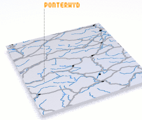 Places with similar names to Pont-erwyd, United Kingdom ::
// Ponte Rotto (IT)
// Ponterotto (IT)
// Pendurada (PT)
// Pondorito (CO)
// Pendurti (IN)
// Peña Dorada (MX)
// Pendarito (VE)
// Ponteyraud (FR)
// Pontruet (FR)
// Piano dʼArta (IT)
Disclaimer :: Information on this page comes without warranty of any kind |
||
|
Where is Pont-erwyd? Elevation and coordinates ::
Latitude (lat): 52°25'0"N Longitude (lon): 3°50'0"W
Elevation (approx.): 240m (map arrows pan, magnifying glasses zoom) |
||
|
Visiting Pont-erwyd? Hotel/Accommodation ::
Book a hotel in Pont-erwyd Travel Guide ::
rental cars ::
car rental offers GPS waypoint ::
download a GPX waypoint (PoI) of Pont-erwyd for your GPS receiver
|
||