|
search place name
|
||
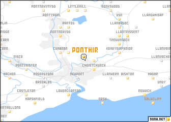
Pont-hir (United Kingdom)Pont-hir is a town in United Kingdom. An overview map of the region around Pont-hir is displayed below.
regional and 3d topo map of Pont-hir, United Kingdom ::
Pont-hir airports ::
The nearest airport is FZO - Bristol Filton, located 28.2 km east of Pont-hir.
Other airports nearby include BRS - Bristol (31.2 km south east), CWL - Cardiff (35.8 km south west), GLO - Golouchestershire Gloucestershire (63.3 km north east), LYE - Lyneham (68.6 km east), Nearby towns ::
Caerleon (1.2km east) //
Christchurch (2.2km south east) //
Llanvihangel Llantarnam (3.0km north west) //
Newport (3.9km south) //
Cwm-brân (3.9km north west) //
Llanwern (5.1km south east) //
Kemeys Inferior (5.0km east) //
Pontnewydd (6.5km north west) //
Panteg (7.8km north) //
Tredunnock (5.9km north east) //
Lower Clapton (7.8km south) //
Griffithstown (8.2km north west) //
Llangibby (7.2km north east) //
Llanbadoc (8.7km north east) //
[all distances 'as the bird flies' and approximate]  Places with similar names to Pont-hir, United Kingdom ::
Disclaimer :: Information on this page comes without warranty of any kind |
||
|
Where is Pont-hir? Elevation and coordinates ::
Latitude (lat): 51°37'0"N Longitude (lon): 2°58'0"W
Elevation (approx.): 47m (map arrows pan, magnifying glasses zoom) |
||
|
Visiting Pont-hir? Hotel/Accommodation ::
Book a hotel in Pont-hir Travel Guide ::
rental cars ::
car rental offers GPS waypoint ::
download a GPX waypoint (PoI) of Pont-hir for your GPS receiver
|
||