|
search place name
|
||
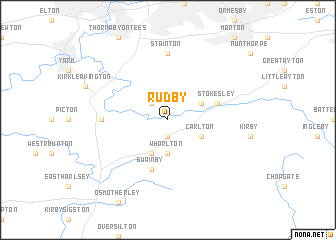
Rudby (United Kingdom)Rudby is a town in United Kingdom. An overview map of the region around Rudby is displayed below.
regional and 3d topo map of Rudby, United Kingdom ::
Rudby airports ::
The nearest airport is MME - Teesside Durham Tees Valley Airport, located 13.4 km north west of Rudby.
Other airports nearby include LBA - Leeds Bradford (70.3 km south west), NCL - Newcastle (71.3 km north west), HUY - Humberside (113.9 km south east), CAX - Carlisle (114.2 km north west), Nearby towns ::
Sexhow (1.9km south) //
Middleton upon Leven (2.1km north west) //
Whorlton (3.7km south) //
Seamer (2.8km north east) //
Carlton (2.8km south east) //
Potto (3.9km south) //
Stokesley (3.7km north east) //
Swainby (5.7km south) //
Stainton (7.4km north) //
Crathorne (4.3km west) //
[all distances 'as the bird flies' and approximate] 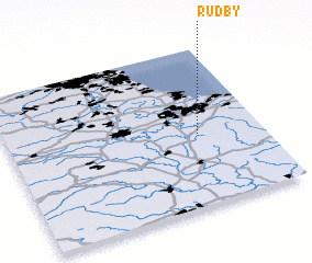 Places with similar names to Rudby, United Kingdom ::
Disclaimer :: Information on this page comes without warranty of any kind |
||
|
Where is Rudby? Elevation and coordinates ::
Latitude (lat): 54°27'0"N Longitude (lon): 1°15'0"W
Elevation (approx.): 68m (map arrows pan, magnifying glasses zoom) |
||
|
Visiting Rudby? Hotel/Accommodation ::
Book a hotel in Rudby Travel Guide ::
rental cars ::
car rental offers GPS waypoint ::
download a GPX waypoint (PoI) of Rudby for your GPS receiver
|
||