|
search place name
|
||
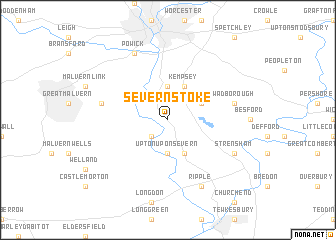
Severn Stoke (United Kingdom)Severn Stoke is a town in United Kingdom. An overview map of the region around Severn Stoke is displayed below.
regional and 3d topo map of Severn Stoke, United Kingdom ::
Severn Stoke airports ::
The nearest airport is GLO - Golouchestershire Gloucestershire, located 23.2 km south of Severn Stoke.
Other airports nearby include BHX - Birmingham (50.7 km north east), FFD - Fairford (55.0 km south east), BZZ - Brize Norton (58.4 km south east), CVT - Coventry (58.6 km north east), Nearby towns ::
Hanley Castle (2.2km south west) //
Draycott (3.7km north) //
Upton upon Severn (3.7km south) //
Kempsey (3.9km north) //
Earls Croome (3.9km south) //
Pirton (2.9km north east) //
Madresfield (4.9km west) //
Wadborough (4.9km east) //
Powick (7.8km north) //
Strensham (5.9km south east) //
Ripple (7.8km south) //
[all distances 'as the bird flies' and approximate] 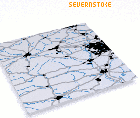 Places with similar names to Severn Stoke, United Kingdom :: Disclaimer :: Information on this page comes without warranty of any kind |
||
|
Where is Severn Stoke? Elevation and coordinates ::
Latitude (lat): 52°6'0"N Longitude (lon): 2°13'0"W
Elevation (approx.): 11m (map arrows pan, magnifying glasses zoom) |
||
|
Visiting Severn Stoke? Hotel/Accommodation ::
Book a hotel in Severn Stoke Travel Guide ::
rental cars ::
car rental offers GPS waypoint ::
download a GPX waypoint (PoI) of Severn Stoke for your GPS receiver
|
||