|
search place name
|
||
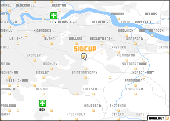
Sidcup (United Kingdom)Sidcup is a town in United Kingdom. An overview map of the region around Sidcup is displayed below.
regional and 3d topo map of Sidcup, United Kingdom ::
Sidcup airports ::
The nearest airport is LCY - London City, located 10.7 km north west of Sidcup.
Other airports nearby include BQH - Biggin Hill (11.2 km south west), LGW - London Gatwick (36.8 km south west), NHT - Northolt (40.1 km west), LHR - London Heathrow (40.8 km west), Nearby towns ::
Foots Cray (1.9km south) //
Saint Mary Cray (3.7km south) //
Bexley (3.0km north east) //
Welling (3.9km north) //
Bexleyheath (4.4km north east) //
Chislehurst (3.9km south west) //
Swanley Junction (5.1km south east) //
Crayford (5.0km east) //
Chelsfield (7.5km south) //
Orpington (7.5km south) //
Bromley (5.0km west) //
Belvedere (7.8km north) //
Plumstead (7.8km north) //
Eltham (5.9km north west) //
Farnborough (8.2km south west) //
[all distances 'as the bird flies' and approximate] 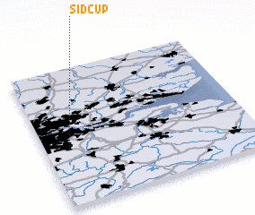
Disclaimer :: Information on this page comes without warranty of any kind |
||
|
Where is Sidcup? Elevation and coordinates ::
Latitude (lat): 51°25'0"N Longitude (lon): 0°7'0"W
Elevation (approx.): 35m (map arrows pan, magnifying glasses zoom) |
||
|
Visiting Sidcup? Hotel/Accommodation ::
Book a hotel in Sidcup Travel Guide ::
rental cars ::
car rental offers GPS waypoint ::
download a GPX waypoint (PoI) of Sidcup for your GPS receiver
|
||