|
search place name
|
||
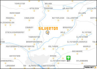
Silverton (United Kingdom)Silverton is a town in United Kingdom. An overview map of the region around Silverton is displayed below.
regional and 3d topo map of Silverton, United Kingdom ::
Silverton airports ::
The nearest airport is EXT - Exeter, located 10.4 km south east of Silverton.
Other airports nearby include PLH - Plymouth (62.1 km south west), YEO - Yeovilton (63.1 km east), CWL - Cardiff (65.3 km north), BRS - Bristol (82.6 km north east), Nearby towns ::
Hele (3.5km east) //
Poltimore (5.7km south) //
Stoke Canon (5.7km south) //
Thorverton (4.0km south west) //
Butterleigh (6.0km north east) //
Brampford Speke (5.1km south west) //
Bradninch (5.0km east) //
Cadbury (5.0km west) //
Broad Clyst (6.6km south east) //
Upton Pyne (7.3km south west) //
Cadeleigh (7.3km north west) //
[all distances 'as the bird flies' and approximate]  Places with similar names to Silverton, United Kingdom ::
// Silverton (US)
// Silvertown (US)
// Silvertown (US)
// Silverton (US)
// Silfurtún (IS)
// Silverton (ZA)
// Silverton (ZA)
// Silvertown (ZA)
// Silverton (US)
// Silverton (US)
Disclaimer :: Information on this page comes without warranty of any kind |
||
|
Where is Silverton? Elevation and coordinates ::
Latitude (lat): 50°49'0"N Longitude (lon): 3°29'0"W
Elevation (approx.): 84m (map arrows pan, magnifying glasses zoom) |
||
|
Visiting Silverton? Hotel/Accommodation ::
Book a hotel in Silverton Travel Guide ::
rental cars ::
car rental offers GPS waypoint ::
download a GPX waypoint (PoI) of Silverton for your GPS receiver
|
||