|
search place name
|
||
Stakenbridge (United Kingdom)Stakenbridge is a town in United Kingdom. An overview map of the region around Stakenbridge is displayed below.
regional and 3d topo map of Stakenbridge, United Kingdom ::

Stakenbridge airports ::
The nearest airport is BHX - Birmingham, located 27.6 km east of Stakenbridge.
Other airports nearby include CVT - Coventry (45.9 km east), GLO - Golouchestershire Gloucestershire (58.2 km south), EMA - Nottingham East Midlands (72.3 km north east), BZZ - Brize Norton (83.7 km south east), Nearby towns ::
Broom (1.9km south) //
Clent (2.3km east) //
Churchill (2.3km west) //
Hagley (2.9km north east) //
Belbroughton (2.9km south east) //
Wollaston (3.9km north) //
Pedmore (3.9km north) //
Lye (4.3km north east) //
Amblecote (5.6km north) //
Wordsley (5.7km north) //
Stourbridge (5.7km north) //
Delph (6.0km north) //
Brettell Lane (7.5km north) //
Chaddesley Corbett (7.5km south) //
Stone (6.5km south west) //
Brierley Hill (7.7km north) //
Kingswinford (7.7km north) //
Cradley (5.8km north east) //
Great Dodford (8.2km south east) //
Netherton (8.7km north east) //
[all distances 'as the bird flies' and approximate] 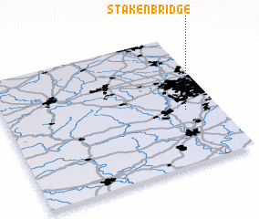 Places with similar names to Stakenbridge, United Kingdom :: Disclaimer :: Information on this page comes without warranty of any kind |
||
|
Where is Stakenbridge? Elevation and coordinates ::
Latitude (lat): 52°25'0"N Longitude (lon): 2°9'0"W
Elevation (approx.): 90m (map arrows pan, magnifying glasses zoom) |
||
|
Visiting Stakenbridge? Hotel/Accommodation ::
Book a hotel in Stakenbridge Travel Guide ::
rental cars ::
car rental offers GPS waypoint ::
download a GPX waypoint (PoI) of Stakenbridge for your GPS receiver
|
||