|
search place name
|
||
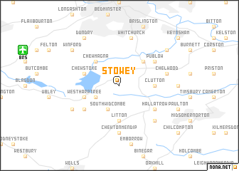
Stowey (United Kingdom)Stowey is a town in United Kingdom. An overview map of the region around Stowey is displayed below.
regional and 3d topo map of Stowey, United Kingdom ::
Stowey airports ::
The nearest airport is BRS - Bristol, located 10.9 km north west of Stowey.
Other airports nearby include FZO - Bristol Filton (20.7 km north), YEO - Yeovilton (36.3 km south), LYE - Lyneham (45.3 km north east), CWL - Cardiff (53.4 km west), Nearby towns ::
South Widcombe (3.9km south) //
North Widcombe (3.0km south west) //
Pensford (4.4km north east) //
Chew Magna (4.4km north west) //
Litton (5.6km south) //
Clutton (3.5km east) //
West Harptree (3.9km south west) //
Chew Stoke (3.9km north west) //
East Harptree (5.1km south west) //
Hallatrow (5.1km south east) //
Publow (5.1km north east) //
Chewton Mendip (7.4km south) //
Chelwood (5.0km east) //
Whitchurch (7.5km north) //
Farrington Gurney (6.6km south east) //
Compton Martin (5.9km south west) //
Compton Dando (7.2km north east) //
Winford (7.2km north west) //
Dundry (8.2km north west) //
[all distances 'as the bird flies' and approximate] 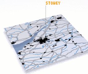 Places with similar names to Stowey, United Kingdom ::
Disclaimer :: Information on this page comes without warranty of any kind |
||
|
Where is Stowey? Elevation and coordinates ::
Latitude (lat): 51°20'0"N Longitude (lon): 2°35'0"W
Elevation (approx.): 90m (map arrows pan, magnifying glasses zoom) |
||
|
Visiting Stowey? Hotel/Accommodation ::
Book a hotel in Stowey Travel Guide ::
rental cars ::
car rental offers GPS waypoint ::
download a GPX waypoint (PoI) of Stowey for your GPS receiver
|
||