|
search place name
|
||
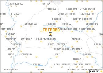
Tetford (United Kingdom)Tetford is a town in United Kingdom. An overview map of the region around Tetford is displayed below.
regional and 3d topo map of Tetford, United Kingdom ::
Tetford airports ::
The nearest airport is QCY - Coningsby, located 20.1 km south west of Tetford.
Other airports nearby include WTN - Waddington (35.1 km west), HUY - Humberside (42.4 km north west), KNF - Marham (77.1 km south east), EMA - Nottingham East Midlands (99.5 km south west), Nearby towns ::
Salmonby (1.9km south) //
Oxcombe (2.2km north west) //
Ruckland (2.2km north east) //
Farforth (3.7km north) //
Ashby (3.7km south) //
Fulletby (2.9km south west) //
Belchford (2.9km north west) //
Worlaby (2.9km north east) //
Somersby (4.3km south east) //
Haugham (5.7km north) //
Burwell (5.0km north east) //
Hagwothingham (6.0km south) //
Lusby (7.5km south) //
Walmsgate (4.8km north east) //
Scamblesby (5.8km north west) //
Harrington (5.8km south east) //
Mareham on the Hill (8.1km south west) //
Little Cawthorpe (8.1km north east) //
[all distances 'as the bird flies' and approximate] 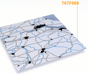 Places with similar names to Tetford, United Kingdom ::
Disclaimer :: Information on this page comes without warranty of any kind |
||
|
Where is Tetford? Elevation and coordinates ::
Latitude (lat): 53°15'0"N Longitude (lon): 0°1'0"W
Elevation (approx.): 60m (map arrows pan, magnifying glasses zoom) |
||
|
Visiting Tetford? Hotel/Accommodation ::
Book a hotel in Tetford Travel Guide ::
rental cars ::
car rental offers GPS waypoint ::
download a GPX waypoint (PoI) of Tetford for your GPS receiver
|
||